Geolocate

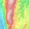
Futenex topographic map

Click on the map to display elevation.

About this map

Name: Futenex topographic map, elevation, terrain.

Location: Futenex, Albens, Entrelacs, Chambéry, Savoie, Auvergne-Rhône-Alpes, France métropolitaine, 73410, France (45.77600 5.91102 45.81600 5.95102)

Average elevation: 476 m

Minimum elevation: 335 m

Maximum elevation: 688 m

Other topographic maps

Click on a map to view its topography, its elevation and its terrain.
Albens

France > Auvergne-Rhône-Alpes > Savoie > Entrelacs

Average elevation: 451 m

La Chambotte

France > Auvergne-Rhône-Alpes > Savoie > Entrelacs

Average elevation: 494 m

Épersy

France > Auvergne-Rhône-Alpes > Savoie > Entrelacs

Average elevation: 472 m

73410

France > Auvergne-Rhône-Alpes > Savoie > Entrelacs

Average elevation: 473 m

Saint-Girod

France > Auvergne-Rhône-Alpes > Savoie > Entrelacs

Average elevation: 432 m

Cessens

France > Auvergne-Rhône-Alpes > Savoie > Entrelacs

Average elevation: 621 m

Gear up for your next adventure:

👟Leg Gaiters - Keep debris, mud, and snow out of your boots
🎒Hiking Daypack - Lightweight and durable backpacks for day trips and excursions
🧴Waterproofing Spray - Restore the DWR coating on jackets and tents
👟Sport Hiking Sandals - Breathable footwear for water crossings and camp rest
🥾Hiking Gaiters - Protect legs and shoes from mud, snow, and debris

As an Amazon Associate, this site earns from qualifying purchases at no extra cost to you.