Geolocate

Nauring topographic map

Click on the map to display elevation.

About this map

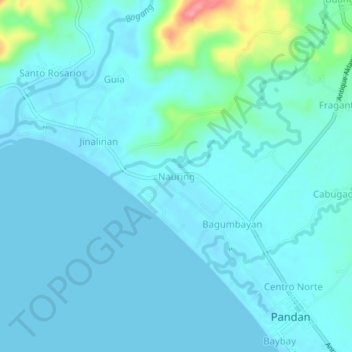
Name: Nauring topographic map, elevation, terrain.

Location: Nauring, Pandan, Antique, Western Visayas, 5712, Philippines (11.71583 122.06133 11.75583 122.10133)

Average elevation: 12 m

Minimum elevation: 0 m

Maximum elevation: 94 m

Gear up for your next adventure:

👖Convertible Hiking Pants - Zip-off legs to adapt to changing weather conditions
🥾Light Hiking Boots - Lightweight and comfortable boots for day hikes
💡LED Camping Lantern - Illuminate your campsite with long-lasting lanterns
🦟Insect Repellent - Keep mosquitoes and black flies away in wooded areas
💧Hydration Bladder - Hands-free hydration solution for long treks

As an Amazon Associate, this site earns from qualifying purchases at no extra cost to you.