Geolocate

Webster City topographic map

Click on the map to display elevation.

About this map

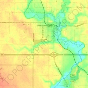
Name: Webster City topographic map, elevation, terrain.

Location: Webster City, Hamilton County, Iowa, 50595, United States (42.42727 -93.85809 42.48596 -93.77428)

Average elevation: 328 m

Minimum elevation: 304 m

Maximum elevation: 343 m

Gear up for your next adventure:

🥾Waterproof Hiking Boots - Boots keeping your feet dry in wet conditions
🧥Thermal Fleece Jacket - Versatile insulation for changing mountain temperatures
🔭Compact Monocular - One-handed bird watching and trail spotting
🥽Outdoor Goggles - Protective eyewear for outdoor activities
🔭Outdoor Binoculars - Lightweight binoculars for birdwatching and hiking

As an Amazon Associate, this site earns from qualifying purchases at no extra cost to you.