Geolocate

Troy topographic map

Click on the map to display elevation.

About this map

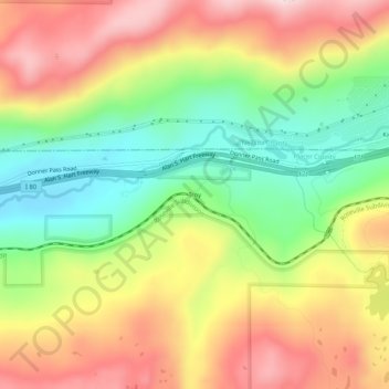
Name: Troy topographic map, elevation, terrain.

Location: Troy, Placer County, California, 95728, United States (39.29157 -120.48298 39.33157 -120.44298)

Average elevation: 1,988 m

Minimum elevation: 1,803 m

Maximum elevation: 2,185 m

Gear up for your next adventure:

🥾Trekking Poles - Adjustable trekking poles to reduce knee stress and improve stability
Backpacking Tent - Lightweight tent for long-distance hiking trips
Camping Coffee Maker - Brew fresh coffee anywhere on the topographic map
👟Sport Hiking Sandals - Breathable footwear for water crossings and camp rest
🥘Camping Cookware Set - Compact nesting pots and pans for trail cooking

As an Amazon Associate, this site earns from qualifying purchases at no extra cost to you.