Geolocate

Wassenaar topographic map

Click on the map to display elevation.

About this map

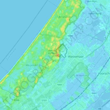
Name: Wassenaar topographic map, elevation, terrain.

Location: Wassenaar, South Holland, Netherlands (52.09477 4.29006 52.19268 4.44394)

Average elevation: 3 m

Minimum elevation: -7 m

Maximum elevation: 28 m

Other topographic maps

Click on a map to view its topography, its elevation and its terrain.

Meijendel

Netherlands > South Holland > Wassenaar

Average elevation: 6 m

Gear up for your next adventure:

🥾Trail Hiking Socks - Comfortable socks to prevent blisters and fatigue
🥾Trekking Boots - Durable boots for long-distance trekking
👟Sport Hiking Sandals - Breathable footwear for water crossings and camp rest
🦯Trekking Poles - Reduced impact on joints for steep topographic climbs
Tent Footprint - Protect tent floor and increase durability

As an Amazon Associate, this site earns from qualifying purchases at no extra cost to you.