
Égine topographic map
Interactive map
Click on the map to display elevation.
About this map
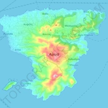
Name: Égine topographic map, elevation, terrain.
Location: Égine, Πέρδικα, Δήμος Αίγινας, Îles, Attique, 18010, Grèce (37.67358 23.41743 37.77511 23.56530)
Average elevation: 60 m
Minimum elevation: -2 m
Maximum elevation: 518 m