Geolocate

Galera topographic map

Click on the map to display elevation.

About this map

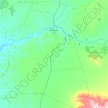
Name: Galera topographic map, elevation, terrain.

Location: Galera, Partido Judicial de Huéscar, Granada, Andalusia, Spain (37.65500 -2.63147 37.77626 -2.49859)

Average elevation: 938 m

Minimum elevation: 755 m

Maximum elevation: 1,584 m

Gear up for your next adventure:

🥾Trail Running Shoes - Lightweight and durable shoes for trail running
🥾Lightweight Hiking Boots - Boots for comfort and mobility on long hikes
🧊Portable Cooler - Keep food and drinks cold during outdoor adventures
🥾Lightweight Hiking Shoes - Comfortable shoes for day hikes
🥾Hiking Gaiters - Protect legs and shoes from mud, snow, and debris

As an Amazon Associate, this site earns from qualifying purchases at no extra cost to you.