
Thank you for supporting this site ❤️
Make a donation
Make a donation
Gear up for your next adventure:
As an Amazon Associate, this site earns from qualifying purchases at no extra cost to you.
Chonchocoro topographic map
Click on the map to display elevation.
Thank you for supporting this site ❤️
Make a donation
Make a donation
Gear up for your next adventure:
As an Amazon Associate, this site earns from qualifying purchases at no extra cost to you.
About this map
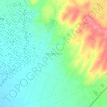
Name: Chonchocoro topographic map, elevation, terrain.
Location: Chonchocoro, Viacha, Ingavi, La Paz, Bolivia (-16.60927 -68.29392 -16.56927 -68.25392)
Average elevation: 3,890 m
Minimum elevation: 3,861 m
Maximum elevation: 3,947 m
Thank you for supporting this site ❤️
Make a donation
Make a donation
Gear up for your next adventure:
As an Amazon Associate, this site earns from qualifying purchases at no extra cost to you.
Other topographic maps
Click on a map to view its topography, its elevation and its terrain.