
Thank you for supporting this site ❤️
Make a donation
Make a donation
Gear up for your next adventure:
As an Amazon Associate, this site earns from qualifying purchases at no extra cost to you.
Turro topographic map
Click on the map to display elevation.
Thank you for supporting this site ❤️
Make a donation
Make a donation
Gear up for your next adventure:
As an Amazon Associate, this site earns from qualifying purchases at no extra cost to you.
About this map
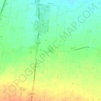
Name: Turro topographic map, elevation, terrain.
Location: Turro, Podenzano, Piacenza, Emilia-Romagna, 29027, Italia (44.96253 9.67436 45.00253 9.71436)
Average elevation: 89 m
Minimum elevation: 69 m
Maximum elevation: 113 m
Thank you for supporting this site ❤️
Make a donation
Make a donation
Gear up for your next adventure:
As an Amazon Associate, this site earns from qualifying purchases at no extra cost to you.