
Thank you for supporting this site ❤️
Make a donation
Make a donation
Gear up for your next adventure:
As an Amazon Associate, this site earns from qualifying purchases at no extra cost to you.
Lluçà topographic map
Click on the map to display elevation.
Thank you for supporting this site ❤️
Make a donation
Make a donation
Gear up for your next adventure:
As an Amazon Associate, this site earns from qualifying purchases at no extra cost to you.
About this map
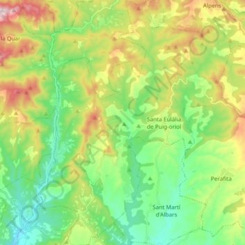
Name: Lluçà topographic map, elevation, terrain.
Location: Lluçà, Lluçanès, Barcelona, Catalonia, 08514, Spain (42.01261 1.99597 42.12168 2.11274)
Average elevation: 738 m
Minimum elevation: 534 m
Maximum elevation: 1,122 m
Thank you for supporting this site ❤️
Make a donation
Make a donation
Gear up for your next adventure:
As an Amazon Associate, this site earns from qualifying purchases at no extra cost to you.