
Thank you for supporting this site ❤️
Make a donation
Make a donation
Gear up for your next adventure:
As an Amazon Associate, this site earns from qualifying purchases at no extra cost to you.
Medraz topographic map
Click on the map to display elevation.
Thank you for supporting this site ❤️
Make a donation
Make a donation
Gear up for your next adventure:
As an Amazon Associate, this site earns from qualifying purchases at no extra cost to you.
About this map
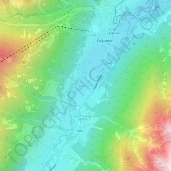
Name: Medraz topographic map, elevation, terrain.
Location: Medraz, Fulpmes, Bezirk Innsbruck-Land, Tyrol, 6166, Austria (47.12253 11.32253 47.16253 11.36253)
Average elevation: 1,277 m
Minimum elevation: 872 m
Maximum elevation: 2,263 m
Thank you for supporting this site ❤️
Make a donation
Make a donation
Gear up for your next adventure:
As an Amazon Associate, this site earns from qualifying purchases at no extra cost to you.