Geolocate

Letur topographic map

Click on the map to display elevation.

About this map

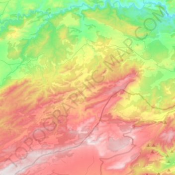
Name: Letur topographic map, elevation, terrain.

Location: Letur, Albacete, Castile-La Mancha, Spain (38.20181 -2.23431 38.41380 -1.99612)

Average elevation: 937 m

Minimum elevation: 433 m

Maximum elevation: 1,485 m

Gear up for your next adventure:

🦟Insect Repellent - Keep mosquitoes and black flies away in wooded areas
🧥Waterproof Pants - Keep dry during rainy hiking conditions
🧢Beanie Hat - Keep your head warm in cold weather
🧴Sunscreen SPF - Broad-spectrum sunscreen for outdoor activities
🐕Hiking Dog Pack - Let your canine companion carry their own water and food

As an Amazon Associate, this site earns from qualifying purchases at no extra cost to you.