Geolocate

Pothamedu topographic map

Click on the map to display elevation.

About this map

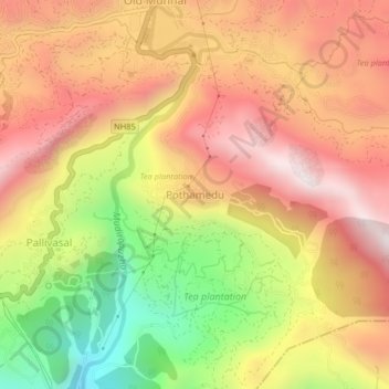
Name: Pothamedu topographic map, elevation, terrain.

Location: Pothamedu, Devikulam, Idukki, Kerala, 685613, India (10.03474 77.04674 10.07474 77.08674)

Average elevation: 1,386 m

Minimum elevation: 859 m

Maximum elevation: 1,782 m

Gear up for your next adventure:

🥫Freeze-Dried Meals - Lightweight, high-calorie nutrition for multi-day treks
📷Outdoor Action Camera - Capture high-elevation views and rugged adventures
🧰Multitool Knife - Compact and versatile tool for outdoor use
🛏️Camping Sleeping Mat - Comfortable mats for sleeping outdoors
🧥Thermal Fleece Jacket - Versatile insulation for changing mountain temperatures

As an Amazon Associate, this site earns from qualifying purchases at no extra cost to you.