Geolocate

Luray topographic map

Click on the map to display elevation.

About this map

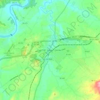
Name: Luray topographic map, elevation, terrain.

Location: Luray, Page County, Virginia, 22835, United States (38.62547 -78.50002 38.70547 -78.42002)

Average elevation: 266 m

Minimum elevation: 208 m

Maximum elevation: 417 m

Other topographic maps

Click on a map to view its topography, its elevation and its terrain.

Stanley

United States > Virginia > Page County

Average elevation: 328 m

Gear up for your next adventure:

🏕️Camping Hammock - Integrated protection for sleeping between trees
🧥Fleece Jacket - Warm and lightweight jacket for layering
Tent Footprint - Protect tent floor and increase durability
💧Hydration Bladder - Hands-free hydration solution for long treks
🧭GPS Outdoor Watch - Smart watch for navigation and fitness tracking in nature

As an Amazon Associate, this site earns from qualifying purchases at no extra cost to you.