Geolocate

Sarii topographic map

Click on the map to display elevation.

About this map

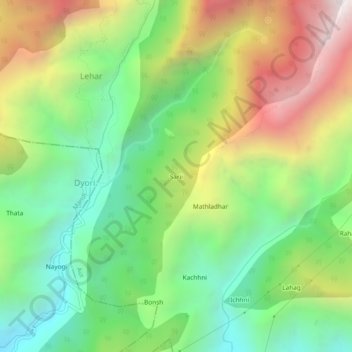
Name: Sarii topographic map, elevation, terrain.

Location: Sarii, Lehar, Aut, Mandi, Himachal Pradesh, 175124, India (31.69942 77.07649 31.73942 77.11649)

Average elevation: 1,671 m

Minimum elevation: 1,024 m

Maximum elevation: 2,649 m

Gear up for your next adventure:

🥾Hiking Shoes - Durable and comfortable shoes for trail hiking
🏃Hydration Running Vest - Carry water and maps close to your body for speed
🐕Hiking Dog Pack - Let your canine companion carry their own water and food
🧦Outdoor Socks - Durable socks designed for hiking and outdoor sports
🔥Emergency Fire Starter - Reliable ignition source for all weather conditions

As an Amazon Associate, this site earns from qualifying purchases at no extra cost to you.