Geolocate

Desuri topographic map

Click on the map to display elevation.

About this map

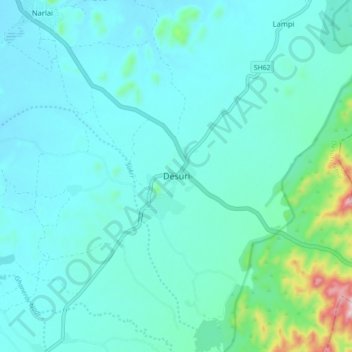
Name: Desuri topographic map, elevation, terrain.

Location: Desuri, Desuri Tehsil, Pali, Rajasthan, 306703, India (25.23947 73.52886 25.31947 73.60886)

Average elevation: 396 m

Minimum elevation: 347 m

Maximum elevation: 706 m

Gear up for your next adventure:

Lightweight Camping Tent - Portable shelter optimized for Canadian backcountry camping
💧Reusable Water Bottle - Durable water bottles for hydration on trails
🧭GPS Handheld Device - Reliable GPS navigation for outdoor adventures
🧥Waterproof Hiking Jacket - Protect yourself from rain and wind while hiking
🧶550 Survival Paracord - Versatile utility cord for emergency repairs and rigging

As an Amazon Associate, this site earns from qualifying purchases at no extra cost to you.