
Thank you for supporting this site ❤️
Make a donation
Make a donation
Gear up for your next adventure:
As an Amazon Associate, this site earns from qualifying purchases at no extra cost to you.
Mælifell topographic map
Click on the map to display elevation.
Thank you for supporting this site ❤️
Make a donation
Make a donation
Gear up for your next adventure:
As an Amazon Associate, this site earns from qualifying purchases at no extra cost to you.
About this map
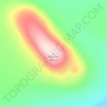
Name: Mælifell topographic map, elevation, terrain.
Location: Mælifell, Vopnafjarðarhreppur, Eastern Region, Iceland (65.69860 -15.35567 65.69870 -15.35557)
Average elevation: 546 m
Minimum elevation: 384 m
Maximum elevation: 826 m
Thank you for supporting this site ❤️
Make a donation
Make a donation
Gear up for your next adventure:
As an Amazon Associate, this site earns from qualifying purchases at no extra cost to you.