
Hrlica topographic map
Interactive map
Click on the map to display elevation.
About this map
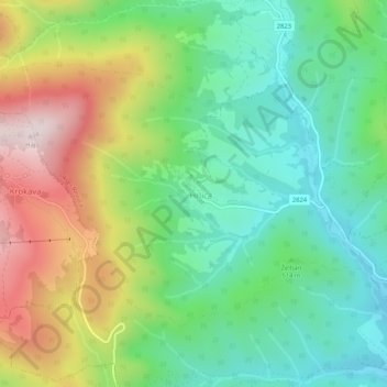
Name: Hrlica topographic map, elevation, terrain.
Average elevation: 528 m
Minimum elevation: 323 m
Maximum elevation: 888 m
Other topographic maps
Click on a map to view its topography, its elevation and its terrain.
Revúca
Slovaquie > Région de Banská Bystrica > okres Revúca
Revúca, okres Revúca, Région de Banská Bystrica, Slovaquie centrale, 050 01, Slovaquie
Average elevation: 575 m
Revúca
Slovaquie > Région de Banská Bystrica > okres Revúca > Revúca > Revúca
Revúca, okres Revúca, Région de Banská Bystrica, Slovaquie centrale, 050 01, Slovaquie
Average elevation: 506 m