
Flint topographic map
Click on the map to display elevation.
About this map
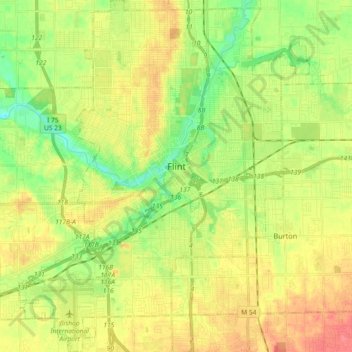
Name: Flint topographic map, elevation, terrain.
Location: Flint, Genesee County, Michigan, United States (42.94564 -83.77228 43.07934 -83.62065)
Average elevation: 236 m
Minimum elevation: 209 m
Maximum elevation: 263 m
Other topographic maps
Click on a map to view its topography, its elevation and its terrain.
Genessee County Recreational Area
United States > Michigan > Genesee County > Genesee Charter Township
Average elevation: 231 m