Geolocate

Seva topographic map

Click on the map to display elevation.

About this map

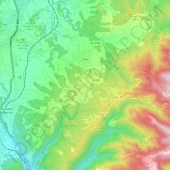
Name: Seva topographic map, elevation, terrain.

Location: Seva, Osona, Barcelona, Catalonia, 08554, Spain (41.78163 2.23181 41.86437 2.34741)

Average elevation: 724 m

Minimum elevation: 427 m

Maximum elevation: 1,262 m

Other topographic maps

Click on a map to view its topography, its elevation and its terrain.

Pla de la Calma

Spain > Catalonia > Osona > el Brull

Average elevation: 1,111 m

Gear up for your next adventure:

🦯Trekking Poles - Reduced impact on joints for steep topographic climbs
💡LED Headlamp - Hands-free illumination for night hiking and camping
🏃Hydration Running Vest - Carry water and maps close to your body for speed
🧥Waterproof Hiking Jacket - Protect yourself from rain and wind while hiking
🧴Bear Spray Holster - Quick-access carry for essential Canadian wilderness safety

As an Amazon Associate, this site earns from qualifying purchases at no extra cost to you.