Geolocate

Valmontone topographic map

Click on the map to display elevation.

About this map

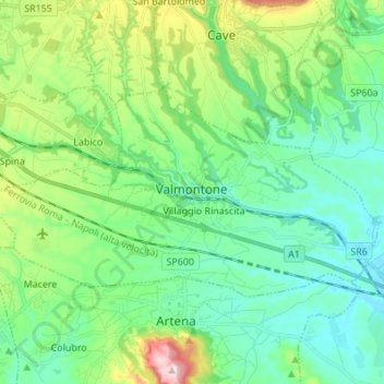
Name: Valmontone topographic map, elevation, terrain.

Location: Valmontone, Roma Capitale, Lazio, 00038, Italy (41.74825 12.84793 41.80412 12.98423)

Average elevation: 313 m

Minimum elevation: 206 m

Maximum elevation: 629 m

Gear up for your next adventure:

👟Leg Gaiters - Keep debris, mud, and snow out of your boots
🥾Trail Hiking Boots - Supportive boots for rough trails
🧢Beanie Hat - Keep your head warm in cold weather
🦯Trekking Poles - Reduced impact on joints for steep topographic climbs
🧼Biodegradable Camp Soap - Environmentally friendly cleaning for gear and body

As an Amazon Associate, this site earns from qualifying purchases at no extra cost to you.