Geolocate

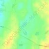
Parsons Beach topographic map

Click on the map to display elevation.

About this map

Name: Parsons Beach topographic map, elevation, terrain.

Location: Parsons Beach, Yorke Peninsula Council, South Australia, 5575, Australia (-34.78410 137.46852 -34.75042 137.49633)

Average elevation: 6 m

Minimum elevation: 0 m

Maximum elevation: 23 m

Other topographic maps

Click on a map to view its topography, its elevation and its terrain.
Gear up for your next adventure:

🛶Kayak Accessories - Essential gear for safe and fun kayaking adventures
🔦LED Headlamp - Hands-free lighting for early morning starts or late finishes
👖Convertible Hiking Pants - Zip-off legs to adapt to changing weather conditions
💡Compact LED Flashlight - Powerful and portable flashlight for outdoor use
🥾Light Trekking Boots - Supportive boots for multi-day treks

As an Amazon Associate, this site earns from qualifying purchases at no extra cost to you.