
Thank you for supporting this site ❤️
Make a donation
Make a donation
Gear up for your next adventure:
As an Amazon Associate, this site earns from qualifying purchases at no extra cost to you.
Turiya topographic map
Click on the map to display elevation.
Thank you for supporting this site ❤️
Make a donation
Make a donation
Gear up for your next adventure:
As an Amazon Associate, this site earns from qualifying purchases at no extra cost to you.
About this map
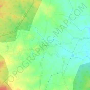
Name: Turiya topographic map, elevation, terrain.
Location: Turiya, Kurai Tahsil, Seoni, Madhya Pradesh, India (21.71624 79.34713 21.75624 79.38713)
Average elevation: 428 m
Minimum elevation: 408 m
Maximum elevation: 458 m
Thank you for supporting this site ❤️
Make a donation
Make a donation
Gear up for your next adventure:
As an Amazon Associate, this site earns from qualifying purchases at no extra cost to you.