
Neustadt an der Weinstraße topographic map
Interactive map
Click on the map to display elevation.
About this map
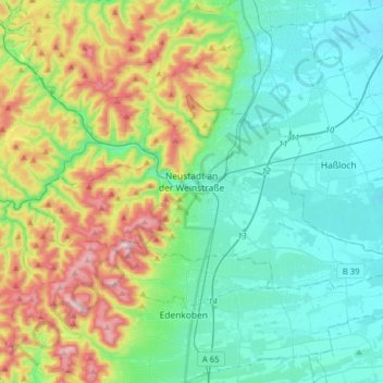
Name: Neustadt an der Weinstraße topographic map, elevation, terrain.
Location: Neustadt an der Weinstraße, Rhineland-Palatinate, Germany (49.29598 8.00097 49.40098 8.31738)
Average elevation: 250 m
Minimum elevation: 99 m
Maximum elevation: 671 m
Other topographic maps
Click on a map to view its topography, its elevation and its terrain.
Neustadt an der Weinstraße
Germany > Rhineland-Palatinate > Neustadt an der Weinstraße
Neustadt an der Weinstraße, Rhineland-Palatinate, 67433, Germany
Average elevation: 251 m