Geolocate

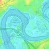
Burswood topographic map

Click on the map to display elevation.

About this map

Name: Burswood topographic map, elevation, terrain.

Location: Burswood, Town of Victoria Park, Western Australia, 6100, Australia (-31.97206 115.88431 -31.93996 115.90381)

Average elevation: 10 m

Minimum elevation: -3 m

Maximum elevation: 34 m

Other topographic maps

Click on a map to view its topography, its elevation and its terrain.
Gear up for your next adventure:

🔦LED Flashlight - Powerful and long-lasting flashlight for camping and emergencies
🧥Waterproof Pants - Keep dry during rainy hiking conditions
🎒Hiking Daypack - Lightweight and durable backpacks for day trips and excursions
⛺Camping Tent - Weather-resistant tents suitable for 2 to 6 people
🦶Anti-Blister Balm - Prevents friction and hotspots during long ascents

As an Amazon Associate, this site earns from qualifying purchases at no extra cost to you.