
Thank you for supporting this site ❤️
Make a donation
Make a donation
Gear up for your next adventure:
As an Amazon Associate, this site earns from qualifying purchases at no extra cost to you.
Ciutadilla topographic map
Click on the map to display elevation.
Thank you for supporting this site ❤️
Make a donation
Make a donation
Gear up for your next adventure:
As an Amazon Associate, this site earns from qualifying purchases at no extra cost to you.
About this map
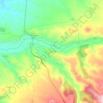
Name: Ciutadilla topographic map, elevation, terrain.
Location: Ciutadilla, Urgell, Lerida, Catalonië, 25341, Spanje (41.54192 1.11973 41.58192 1.15973)
Average elevation: 517 m
Minimum elevation: 410 m
Maximum elevation: 648 m
Thank you for supporting this site ❤️
Make a donation
Make a donation
Gear up for your next adventure:
As an Amazon Associate, this site earns from qualifying purchases at no extra cost to you.