Geolocate

Westcliffe topographic map

Click on the map to display elevation.

About this map

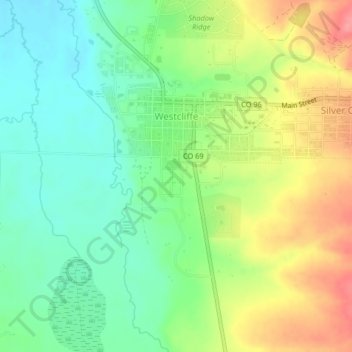
Name: Westcliffe topographic map, elevation, terrain.

Location: Westcliffe, Custer County, Colorado, United States (38.11315 -105.47796 38.14534 -105.45817)

Average elevation: 2,404 m

Minimum elevation: 2,370 m

Maximum elevation: 2,454 m

Gear up for your next adventure:

Backpacking Tent - Lightweight tent for long-distance hiking trips
🧴Sunscreen SPF - Broad-spectrum sunscreen for outdoor activities
🧊Portable Cooler - Keep food and drinks cold during outdoor adventures
🛌Down Sleeping Bag - Superior warmth-to-weight ratio for cold nights
🚲Handlebar Phone Mount - View topographic-map.com live while cycling

As an Amazon Associate, this site earns from qualifying purchases at no extra cost to you.