
Thank you for supporting this site ❤️
Make a donation
Make a donation
Gear up for your next adventure:
As an Amazon Associate, this site earns from qualifying purchases at no extra cost to you.
Brezojevica topographic map
Click on the map to display elevation.
Thank you for supporting this site ❤️
Make a donation
Make a donation
Gear up for your next adventure:
As an Amazon Associate, this site earns from qualifying purchases at no extra cost to you.
About this map
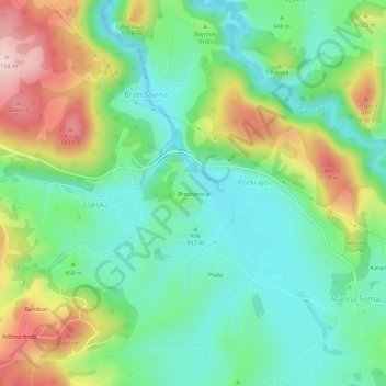
Name: Brezojevica topographic map, elevation, terrain.
Location: Brezojevica, Potkrajci, Pljevlja Municipality, Montenegro (43.20725 19.40827 43.24725 19.44827)
Average elevation: 962 m
Minimum elevation: 862 m
Maximum elevation: 1,153 m
Thank you for supporting this site ❤️
Make a donation
Make a donation
Gear up for your next adventure:
As an Amazon Associate, this site earns from qualifying purchases at no extra cost to you.