
Thank you for supporting this site ❤️
Make a donation
Make a donation
Gear up for your next adventure:
As an Amazon Associate, this site earns from qualifying purchases at no extra cost to you.
Menaceur topographic map
Click on the map to display elevation.
Thank you for supporting this site ❤️
Make a donation
Make a donation
Gear up for your next adventure:
As an Amazon Associate, this site earns from qualifying purchases at no extra cost to you.
About this map
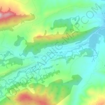
Name: Menaceur topographic map, elevation, terrain.
Location: Menaceur, Daïra Sidi Amar, Tipaza, Algérie (36.47396 2.22390 36.51396 2.26390)
Average elevation: 276 m
Minimum elevation: 125 m
Maximum elevation: 626 m
Thank you for supporting this site ❤️
Make a donation
Make a donation
Gear up for your next adventure:
As an Amazon Associate, this site earns from qualifying purchases at no extra cost to you.