Geolocate

Dinara topographic map

Click on the map to display elevation.

About this map

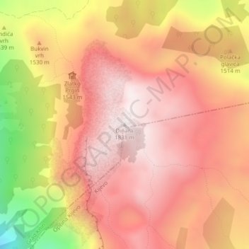
Name: Dinara topographic map, elevation, terrain.

Location: Dinara, Grad Knin, Šibenik-Knin County, Croatia (44.06243 16.38286 44.06253 16.38296)

Average elevation: 1,516 m

Minimum elevation: 907 m

Maximum elevation: 1,822 m

Gear up for your next adventure:

🪜Heavy Duty Carabiners - Multi-use clips for securing gear to your backpack
🥾Light Hiking Boots - Lightweight and comfortable boots for day hikes
🧢Beanie Hat - Keep your head warm in cold weather
🔋Solar Power Bank - Keep your GPS and devices charged during long outdoor trips
🥽Outdoor Goggles - Protective eyewear for outdoor activities

As an Amazon Associate, this site earns from qualifying purchases at no extra cost to you.