Geolocate

Qadian topographic map

Click on the map to display elevation.

Qadian

Qadian is located at 31°49′N 75°23′E / 31.82°N 75.39°E / 31.82; 75.39. It has an average elevation of 250 metres (820 feet).

About this map

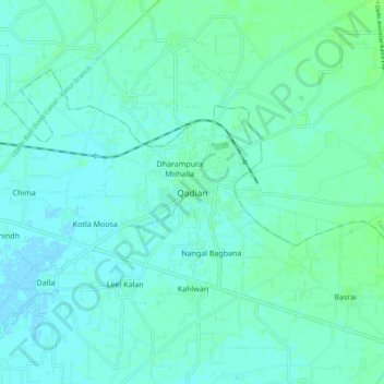
Name: Qadian topographic map, elevation, terrain.

Location: Qadian, Batala Tahsil, Gurdaspur district, Punjab, 143516, India (31.77942 75.33581 31.85942 75.41581)

Average elevation: 255 m

Minimum elevation: 252 m

Maximum elevation: 260 m

Gear up for your next adventure:

🧢Sun Hat - Wide-brim hat for sun protection
🔦LED Headtorch - Bright and durable light for night activities
🏃Hydration Running Vest - Carry water and maps close to your body for speed
🥾All-Terrain Hiking Boots - Versatile boots for varied hiking conditions
🛶Kayak Dry Bag - Waterproof storage for kayaking adventures

As an Amazon Associate, this site earns from qualifying purchases at no extra cost to you.