Geolocate

Usseln topographic map

Click on the map to display elevation.

About this map
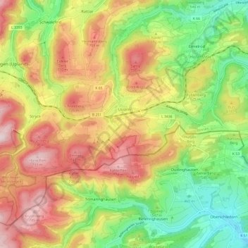
Name: Usseln topographic map, elevation, terrain.

Location: Usseln, Willingen (Upland), Landkreis Waldeck-Frankenberg, Hessen, 34508, Duitsland (51.24655 8.58453 51.30766 8.70416)

Average elevation: 594 m

Minimum elevation: 402 m

Maximum elevation: 804 m

Other topographic maps

Click on a map to view its topography, its elevation and its terrain.

Gear up for your next adventure:

🧥Thermal Layer - Insulating layer for cold outdoor conditions
🚲Heavy Duty Bike Lock - Secure your bike at the trailhead or during stops
🧥Waterproof Pants - Keep dry during rainy hiking conditions
🚲MTB Frame Bag - Carry tools and maps directly on your bicycle frame
🧢Beanie Hat - Keep your head warm in cold weather

As an Amazon Associate, this site earns from qualifying purchases at no extra cost to you.