
Thank you for supporting this site ❤️
Make a donation
Make a donation
Gear up for your next adventure:
As an Amazon Associate, this site earns from qualifying purchases at no extra cost to you.
Valstagna topographic map
Click on the map to display elevation.
Thank you for supporting this site ❤️
Make a donation
Make a donation
Gear up for your next adventure:
As an Amazon Associate, this site earns from qualifying purchases at no extra cost to you.
About this map
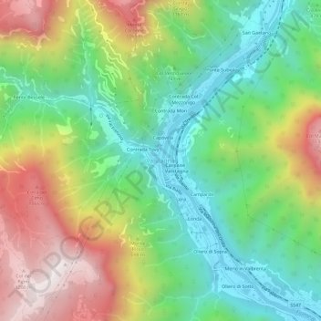
Name: Valstagna topographic map, elevation, terrain.
Location: Valstagna, Valbrenta, Vicenza, Veneto, 36029, Italy (45.83997 11.63835 45.87997 11.67835)
Average elevation: 556 m
Minimum elevation: 129 m
Maximum elevation: 1,237 m
Thank you for supporting this site ❤️
Make a donation
Make a donation
Gear up for your next adventure:
As an Amazon Associate, this site earns from qualifying purchases at no extra cost to you.