
Thank you for supporting this site ❤️
Make a donation
Make a donation
Gear up for your next adventure:
As an Amazon Associate, this site earns from qualifying purchases at no extra cost to you.
Moudjebara topographic map
Click on the map to display elevation.
Thank you for supporting this site ❤️
Make a donation
Make a donation
Gear up for your next adventure:
As an Amazon Associate, this site earns from qualifying purchases at no extra cost to you.
About this map
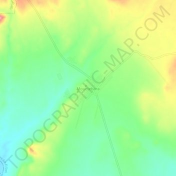
Name: Moudjebara topographic map, elevation, terrain.
Location: Moudjebara, Daïra Aïn El Ibel, Djelfa, Algérie (34.48334 3.44997 34.52334 3.48997)
Average elevation: 1,047 m
Minimum elevation: 1,000 m
Maximum elevation: 1,119 m
Thank you for supporting this site ❤️
Make a donation
Make a donation
Gear up for your next adventure:
As an Amazon Associate, this site earns from qualifying purchases at no extra cost to you.