Geolocate

Trumann topographic map

Click on the map to display elevation.

About this map

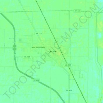
Name: Trumann topographic map, elevation, terrain.

Location: Trumann, Poinsett County, Arkansas, 72472, United States (35.63528 -90.55737 35.71528 -90.47737)

Average elevation: 67 m

Minimum elevation: 62 m

Maximum elevation: 71 m

Gear up for your next adventure:

Family Camping Tent - Spacious tent suitable for family camping trips
🥾All-Terrain Hiking Boots - Versatile boots for varied hiking conditions
🧤Rechargeable Heated Gloves - Extreme warmth for Canadian winter expeditions
💡Portable Camping Lamp - Rechargeable lamp for campsite lighting
🔥Camping Stove - Portable stoves to cook outdoors with ease

As an Amazon Associate, this site earns from qualifying purchases at no extra cost to you.