
Ban Chang topographic map
Interactive map
Click on the map to display elevation.
About this map
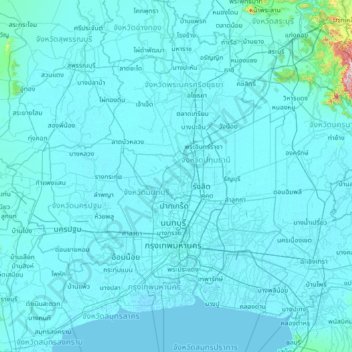
Name: Ban Chang topographic map, elevation, terrain.
Location: Ban Chang, Pathum Thani Province, Thailand (13.32760 99.80748 14.72760 101.20748)
Average elevation: 16 m
Minimum elevation: -4 m
Maximum elevation: 989 m