Geolocate

Burrow topographic map

Click on the map to display elevation.

About this map

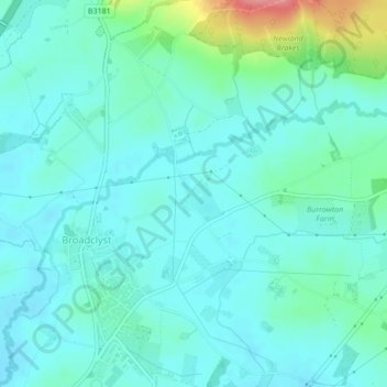
Name: Burrow topographic map, elevation, terrain.

Location: Burrow, Broadclyst, East Devon, Devon, England, United Kingdom (50.76786 -3.43330 50.77076 -3.43043)

Average elevation: 30 m

Minimum elevation: 12 m

Maximum elevation: 107 m

Gear up for your next adventure:

🥾Lightweight Hiking Boots - Boots for comfort and mobility on long hikes
🥾Hiking Shorts - Breathable shorts suitable for summer hikes
🧊Portable Cooler - Keep food and drinks cold during outdoor adventures
💡Solar Camping Lamp - Eco-friendly lighting for campsites
🧴Sunscreen SPF - Broad-spectrum sunscreen for outdoor activities

As an Amazon Associate, this site earns from qualifying purchases at no extra cost to you.