Geolocate

Bertram topographic map

Click on the map to display elevation.

About this map

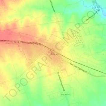
Name: Bertram topographic map, elevation, terrain.

Location: Bertram, Burnet County, Texas, 78605, United States (30.73421 -98.08526 30.75270 -98.03934)

Average elevation: 372 m

Minimum elevation: 337 m

Maximum elevation: 398 m

Gear up for your next adventure:

🧢Hiking Hat - Sun-protective and breathable hats for long treks
Camping Coffee Maker - Brew fresh coffee anywhere on the topographic map
👟Leg Gaiters - Keep debris, mud, and snow out of your boots
🎒Backpack Rain Cover - External shield to keep your entire pack dry
🛶Kayak Dry Bag - Waterproof storage for kayaking adventures

As an Amazon Associate, this site earns from qualifying purchases at no extra cost to you.