Geolocate

Inanuran topographic map

Click on the map to display elevation.

About this map

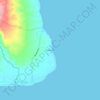
Name: Inanuran topographic map, elevation, terrain.

Location: Inanuran, Talisay, Quezon, Calabarzon, Philippines (13.21186 122.68027 13.25186 122.72027)

Average elevation: 17 m

Minimum elevation: 0 m

Maximum elevation: 143 m

Gear up for your next adventure:

Camping Essentials - All-in-one gear for a comfortable camping trip
🎒Backpack Rain Cover - External shield to keep your entire pack dry
🥾Lightweight Hiking Shoes - Comfortable shoes for day hikes
🧭Orienteering Kit - Tools for map reading and navigation in the wild
💡LED Headlamp - Hands-free illumination for night hiking and camping

As an Amazon Associate, this site earns from qualifying purchases at no extra cost to you.