
Make a donation
Gear up for your next adventure:
As an Amazon Associate, this site earns from qualifying purchases at no extra cost to you.
Col Bayard topographic map
Click on the map to display elevation.
Make a donation
Gear up for your next adventure:
As an Amazon Associate, this site earns from qualifying purchases at no extra cost to you.
Col Bayard
Le col Bayard (altitude 1 250 mètres) est l'un des principaux points de franchissement de la ligne de partage des eaux entre le bassin de la Durance (par son affluent la Luye) et celui de l'Isère (par son affluent le Drac). Il est à 8 kilomètres au nord de Gap et à 90 kilomètres au sud de Grenoble.
Make a donation
Gear up for your next adventure:
As an Amazon Associate, this site earns from qualifying purchases at no extra cost to you.
About this map
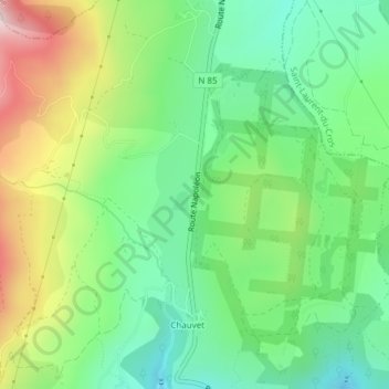
Name: Col Bayard topographic map, elevation, terrain.
Average elevation: 1,292 m
Minimum elevation: 1,139 m
Maximum elevation: 1,566 m
Make a donation
Gear up for your next adventure:
As an Amazon Associate, this site earns from qualifying purchases at no extra cost to you.