Geolocate

Saliskote topographic map

Click on the map to display elevation.

About this map

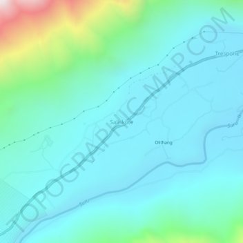
Name: Saliskote topographic map, elevation, terrain.

Location: Saliskote, Sankoo, Kargil district, Ladakh, India (34.38887 75.99394 34.42887 76.03394)

Average elevation: 3,025 m

Minimum elevation: 2,811 m

Maximum elevation: 4,081 m

Gear up for your next adventure:

🚲Heavy Duty Bike Lock - Secure your bike at the trailhead or during stops
🎒Backpack Rain Cover - External shield to keep your entire pack dry
🥾Light Hiking Boots - Lightweight and comfortable boots for day hikes
🦯Trekking Poles - Reduced impact on joints for steep topographic climbs
🪜Heavy Duty Carabiners - Multi-use clips for securing gear to your backpack

As an Amazon Associate, this site earns from qualifying purchases at no extra cost to you.