
Råna topographic map
Interactive map
Click on the map to display elevation.
About this map
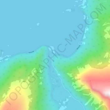
Name: Råna topographic map, elevation, terrain.
Location: Råna, Narvik, Nordland, Noorwegen (68.33552 16.99149 68.37552 17.03149)
Average elevation: 172 m
Minimum elevation: 0 m
Maximum elevation: 980 m
Other topographic maps
Click on a map to view its topography, its elevation and its terrain.
Langvatnet - Guddumjávvre
Langvatnet - Guddumjávvre, Gildeskål, Nordland, Noorwegen
Average elevation: 394 m