Geolocate

Agrovilla topographic map

Click on the map to display elevation.

About this map

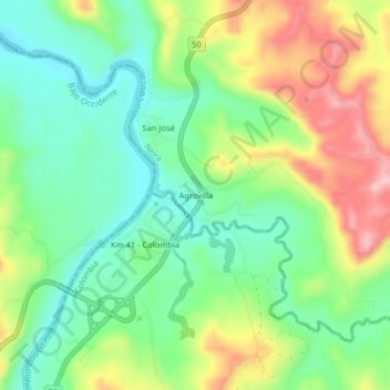
Name: Agrovilla topographic map, elevation, terrain.

Location: Agrovilla, Neira, Centrosur, Caldas, Colombia (5.14589 -75.67787 5.18589 -75.63787)

Average elevation: 848 m

Minimum elevation: 772 m

Maximum elevation: 972 m

Other topographic maps

Click on a map to view its topography, its elevation and its terrain.

Neira

Colombia > Caldas > Neira

Average elevation: 1,870 m

Gear up for your next adventure:

🛁Quick-Dry Microfiber Towel - Space-saving towel that dries rapidly on the move
🚑Survival Whistle - Signal for help across long distances in mountains
🛏️Camping Sleeping Mat - Comfortable mats for sleeping outdoors
🧥Fleece Jacket - Warm and lightweight jacket for layering
🥾Light Trekking Boots - Supportive boots for multi-day treks

As an Amazon Associate, this site earns from qualifying purchases at no extra cost to you.