Geolocate

Arauca topographic map

Click on the map to display elevation.

About this map

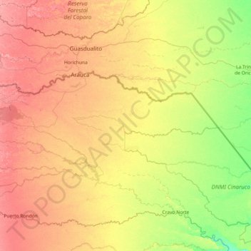
Name: Arauca topographic map, elevation, terrain.

Location: Arauca, RAP Llanos, 810001, Colombia (6.48394 -71.20627 7.10424 -69.76136)

Average elevation: 128 m

Minimum elevation: 91 m

Maximum elevation: 184 m

Other topographic maps

Click on a map to view its topography, its elevation and its terrain.

Puerto Nariño

Colombia > Arauca > Saravena

Average elevation: 182 m

Gear up for your next adventure:

🚲Handlebar Phone Mount - View topographic-map.com live while cycling
🔦UV Flashlight - Detect minerals or specific insects in the dark
🔭Outdoor Binoculars - Lightweight binoculars for birdwatching and hiking
Backpacking Tent - Lightweight tent for long-distance hiking trips
👟Sport Hiking Sandals - Breathable footwear for water crossings and camp rest

As an Amazon Associate, this site earns from qualifying purchases at no extra cost to you.