Geolocate

Anthireddyguda topographic map

Click on the map to display elevation.

About this map

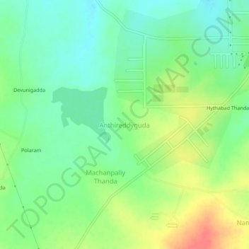
Name: Anthireddyguda topographic map, elevation, terrain.

Location: Anthireddyguda, Shabad mandal, Ranga Reddy, Telangana, India (17.19190 78.15142 17.23190 78.19142)

Average elevation: 595 m

Minimum elevation: 574 m

Maximum elevation: 628 m

Gear up for your next adventure:

🥾Lightweight Hiking Boots - Boots for comfort and mobility on long hikes
🧦Hiking Socks - Moisture-wicking and comfortable socks for long hikes
🥾Trail Running Boots - Durable shoes designed for trail running
🧥Packable Rain Jacket - Breathable waterproof layer for unpredictable weather
🛏️Camping Sleeping Mat - Comfortable mats for sleeping outdoors

As an Amazon Associate, this site earns from qualifying purchases at no extra cost to you.