

Dietzenbach topographic map
Click on the map to display elevation.
Dietzenbach
Hexenberg, whose name is German for “Witches’ Mountain”, is a constituent community. It is named after the highest elevation in Offenbach district. The buildings are mostly relatively low one-family and multiple-family dwellings as well as a few smaller shops in the middle of the community.
About this map
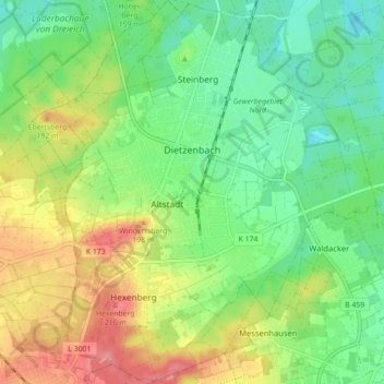
Name: Dietzenbach topographic map, elevation, terrain.
Location: Dietzenbach, Landkreis Offenbach, Hesse, 63128, Germany (49.98256 8.74756 50.03925 8.82671)
Average elevation: 155 m
Minimum elevation: 121 m
Maximum elevation: 208 m
Other topographic maps
Click on a map to view its topography, its elevation and its terrain.
