Geolocate

Kogelberg topographic map

Click on the map to display elevation.

About this map

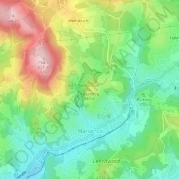
Name: Kogelberg topographic map, elevation, terrain.

Location: Kogelberg, Graz, Styria, 8044, Austria (47.10787 15.47980 47.10797 15.47990)

Average elevation: 486 m

Minimum elevation: 389 m

Maximum elevation: 643 m

Gear up for your next adventure:

🥾Waterproof Hiking Boots - Boots keeping your feet dry in wet conditions
🕶️Polarized Sunglasses - Reduces glare from snow and water at high elevations
🥾Light Hiking Boots - Lightweight and comfortable boots for day hikes
🧰Multitool Knife - Compact and versatile tool for outdoor use
🧥Waterproof Hiking Jacket - Protect yourself from rain and wind while hiking

As an Amazon Associate, this site earns from qualifying purchases at no extra cost to you.