Geolocate

Plankstetten topographic map

Click on the map to display elevation.

Plankstetten

Das Pfarrdorf befindet sich etwa viereinhalb Kilometer südsüdöstlich von Berching und liegt auf einer Höhe von etwa 400 m ü. NHN.

Wikipedia (CC-BY-SA 3.0)

About this map

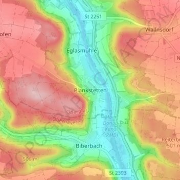
Name: Plankstetten topographic map, elevation, terrain.

Location: Plankstetten, Berching, Landkreis Neumarkt in der Oberpfalz, Bayern, 92334, Deutschland (49.05009 11.43286 49.09009 11.47286)

Average elevation: 467 m

Minimum elevation: 371 m

Maximum elevation: 549 m

Gear up for your next adventure:

🥾Lightweight Hiking Boots - Boots for comfort and mobility on long hikes
🪜Heavy Duty Carabiners - Multi-use clips for securing gear to your backpack
🧣Merino Neck Gaiter - Protects against wind, sun, and cold at high altitudes
🧰Multitool Knife - Compact and versatile tool for outdoor use
🧥Packable Rain Jacket - Breathable waterproof layer for unpredictable weather

As an Amazon Associate, this site earns from qualifying purchases at no extra cost to you.