
Thank you for supporting this site ❤️
Make a donation
Make a donation
Gear up for your next adventure:
As an Amazon Associate, this site earns from qualifying purchases at no extra cost to you.
Boudraâ topographic map
Click on the map to display elevation.
Thank you for supporting this site ❤️
Make a donation
Make a donation
Gear up for your next adventure:
As an Amazon Associate, this site earns from qualifying purchases at no extra cost to you.
About this map
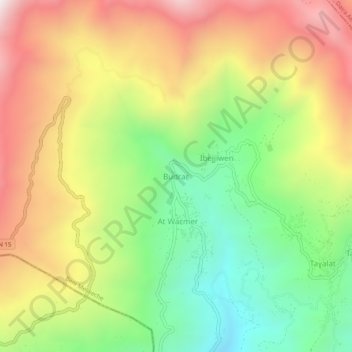
Name: Boudraâ topographic map, elevation, terrain.
Location: Boudraâ, Beni Melikeche, Daïra Tazmalt, Béjaïa, 06039, Algérie (36.43191 4.37711 36.47191 4.41711)
Average elevation: 1,132 m
Minimum elevation: 612 m
Maximum elevation: 1,723 m
Thank you for supporting this site ❤️
Make a donation
Make a donation
Gear up for your next adventure:
As an Amazon Associate, this site earns from qualifying purchases at no extra cost to you.