Geolocate

Balimbing topographic map

Click on the map to display elevation.

About this map

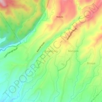
Name: Balimbing topographic map, elevation, terrain.

Location: Balimbing, Calaca, Batangas, Calabarzon, Philippines (13.99304 120.81052 14.03304 120.85052)

Average elevation: 336 m

Minimum elevation: 196 m

Maximum elevation: 533 m

Gear up for your next adventure:

🥾Trail Hiking Boots - Supportive boots for rough trails
🚲Handlebar Phone Mount - View topographic-map.com live while cycling
🛰️Satellite Messenger - Emergency communication for areas with no cell service
🥾Hiking Boots - Sturdy boots providing ankle support and traction on rugged trails
🪑Ultralight Camping Stool - Compact seating for rest stops during long hikes

As an Amazon Associate, this site earns from qualifying purchases at no extra cost to you.